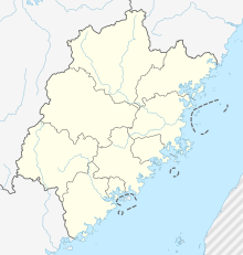
Xiamen Island
Appearance
 Xiamen Island, looking south | |
| Geography | |
|---|---|
| Location | Taiwan Strait |
| Coordinates | 24°29′36″N 118°08′11″E / 24.4932°N 118.1363°E |
| Area | 155.89 km2 (60.19 sq mi) |
| Administration | |
China | |
| Demographics | |
| Population | 1,847,047 (2016) |
| Pop. density | 11,848.4/km2 (30687.2/sq mi) |
Xiamen Island, alternately known as Amoy Island from its Hokkien pronunciation, is an island in southeastern Fujian, China, on the Taiwan Strait. It is administered by the People's Republic of China as the Huli and Siming urban districts of the sub-provincial city of Xiamen. The Gaoji Causeway is to the North, the old Yundang Harbor (now an inclosed lake), is to the West. The Kinmen Islands, controlled by the Republic of China, are to the South East. It has an area of 155.89 square kilometers (60.19 sq mi). With a population of 1,847,047 people, it forms the core of the city's special economic zone.[1]
See also
[edit]References
[edit]- ^ Fodor's China, 2016 edition

